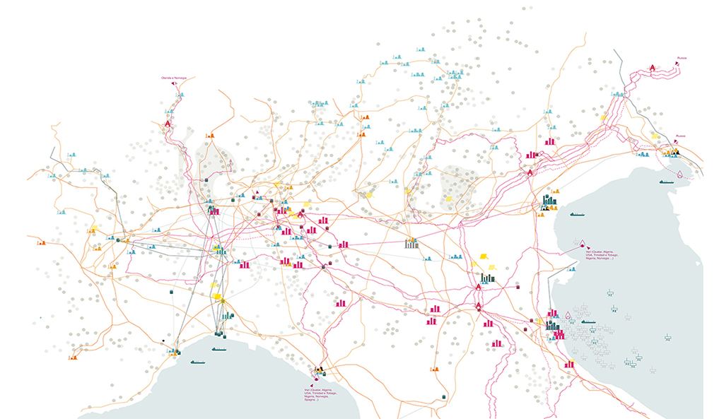
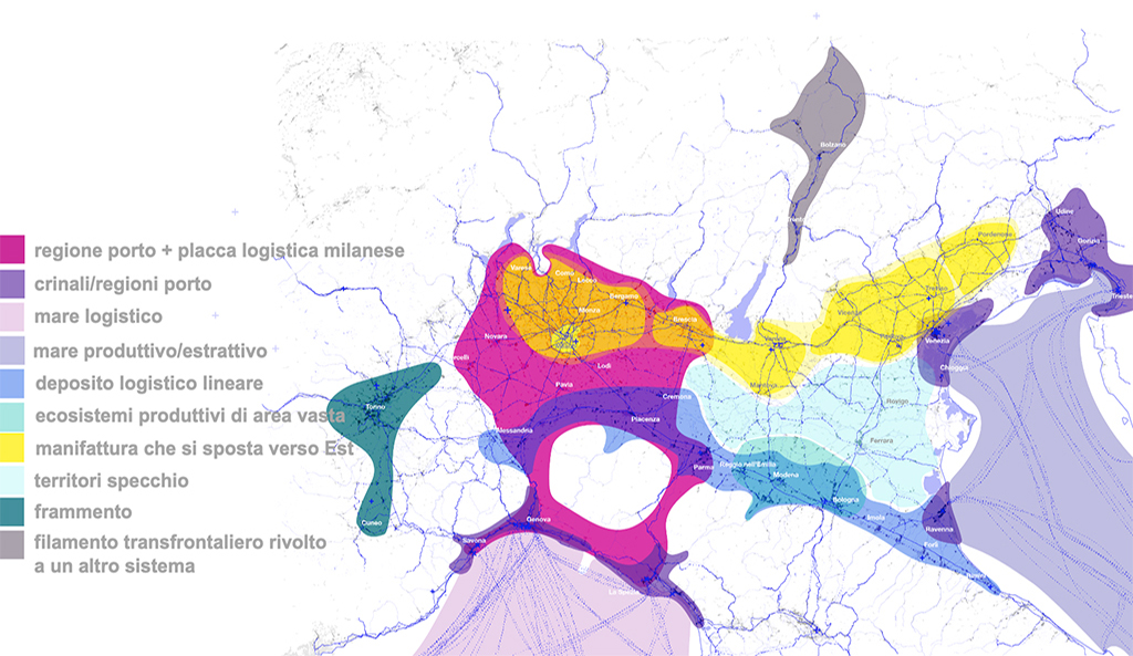
OPERATIONAL GEOGRAPHIES Spatial strategies and dynamic maps of regional urbanization A basic research project on new forms of production from Northern Italy Quadrante Europa, Verona. Elaborated from Google Maps 2022 Two ‘territorial sentinels’. Between Bergamo and Brescia / Mantua Eastavailable online from 04.18.2024 Roles and tools of policymakers for territories of production 05.17.2023 Open talk on new forms of production in Northern Italy 12.02.2022 San Martino industrial district in Trecate (Novara). Elaborated from Google Maps 2022 Striking elements Relational figures in Northen Italy Super-concentrations Amazon Centre and Rovigo Photovoltaic park in San Bellino (Rovigo). Elaborated from Google Maps 2022 How are the territories of production, exchange and support of large concentrations and dispersions changing in regional urbanisation as a result of recent global crises? How to trace their geographies, spatial strategies, actors and powers emerging in a framework of accelerated planning and increasing complexity? How can we be content with an interpretation that tells us that cities and regions are losers or successful, metropolitan or remote, if this reading stops at the ‘flat’ contiguity of administrative boundaries? Vado Gateway, port of Vado Ligure (Savona) – Ports of Genoa. Elaborated from Google Maps 2022